Topo Two – Part II of Topographic Murals
Should you decide to use a topographic map for a mural, you will be pleased to learn that great maps are more plentiful and topo maps have some features not found in a NOAA nautical chart.
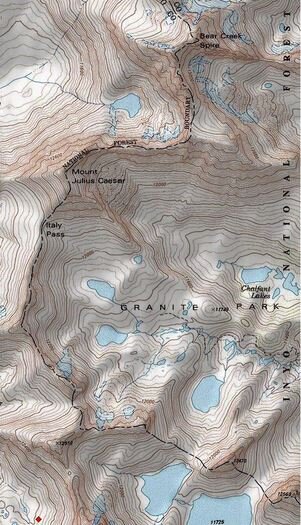
For example, you can order your chart with shading to show a 3-D effect and make it easier to visualize the height of the hills and mountains within. (See the Inyo National Forest illustration for a splendid shading example.)
Here are a couple of websites where you can check out topographic maps:
First, the obvious choice: The United States Geologic Survey (USGS) which can be found at http://store.usgs.gov/
Another good site is My Topo, found at http://www.mytopo.com
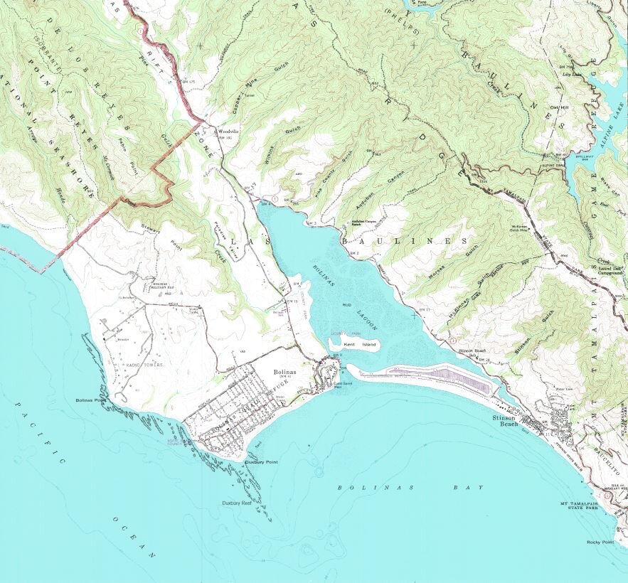
I tested My Topo out by ordering a chart of one of my favorite vacation spots where my high school buddies and I used to spend our Easter vacations: Stinson Beach California. This wonderful beach is just a short drive north of San Francisco via the Golden Gate Bridge. I ordered the chart last Friday and it was on my doorstep Monday afternoon! Great service and the chart plus shipping was $21.40. However, shipping charges could be more or less depending on where you live.
There are other on-demand topo printing sites besides these two. A search on your browser will yield quite a few more options.
Still, a better alternative is to go to your local outdoor recreation store and ask to see the topographic maps of your area. Bring a magnifying glass with you to see if the quality of the printing is good. Remember, whenever an image is enlarged, some diffusion occurs. The better the topo image, the better it will enlarge. Also, pick out a map that is not folded if at all possible. Rolled maps work much better in the preparation process, and are easy for you to ship to me.
So is a topo your type? Or maybe you are still looking for something different for your home or office mural? You will definitely want to watch this blog in the coming weeks. We may have a surprise or two for you!